All posts by HAL21-_Admin

Albania the Accursed Mountains

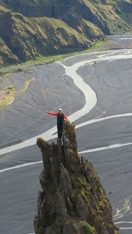
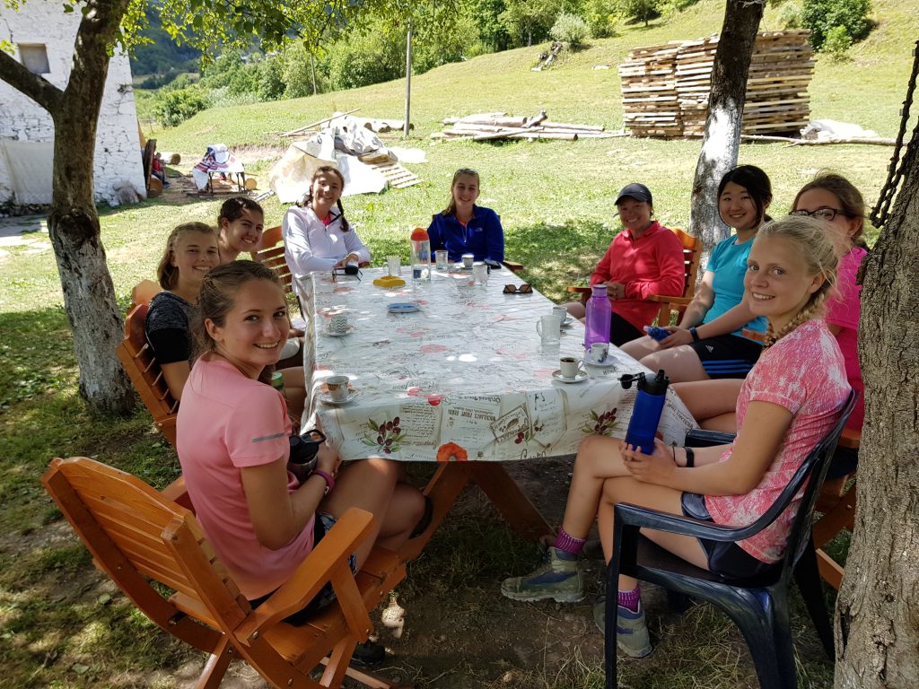
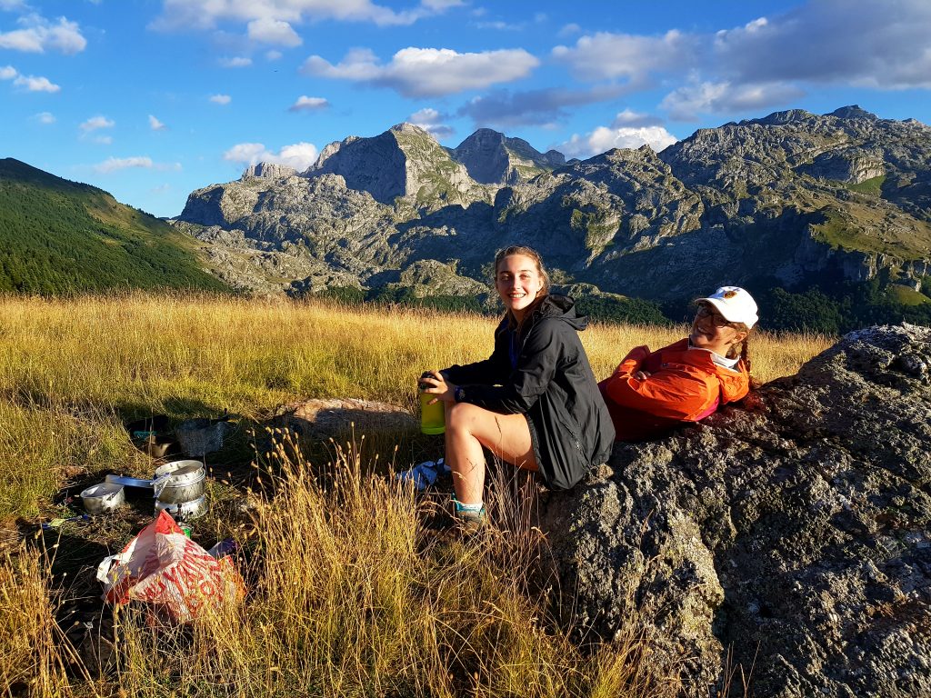
It’s July and I am leading a group of Gold DofE students who chose to come on an expedition to Albania from a number of alternative European options. We have passports, tickets, insurance and a credit card, what could go wrong?!!
0400 in London Heathrow airport (our flight was changed from a much more respectable 11am departure) and  despite actually having a plane e-ticket one of the students wasn’t on the flight passenger list so wasn’t allowed on the plane! After a few phone calls we sorted the situation out. Hurrah for backup plans! 

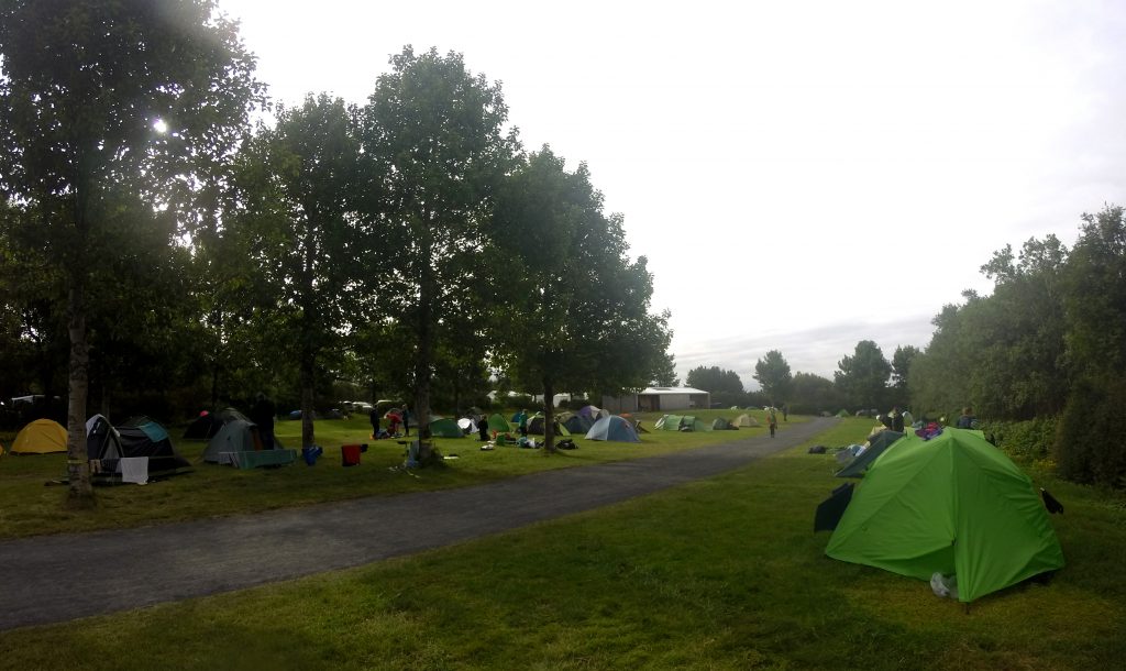
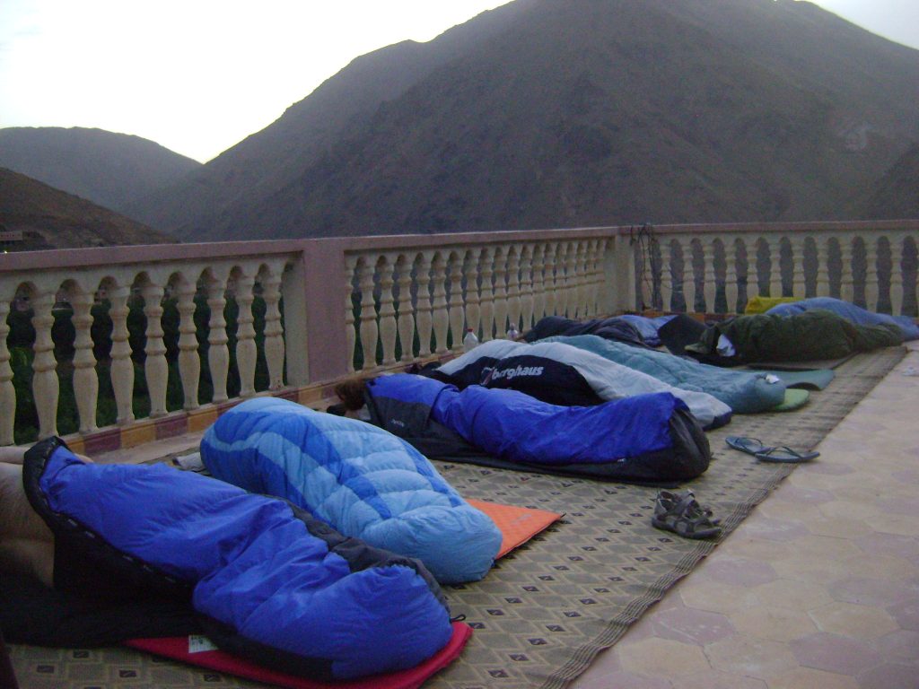
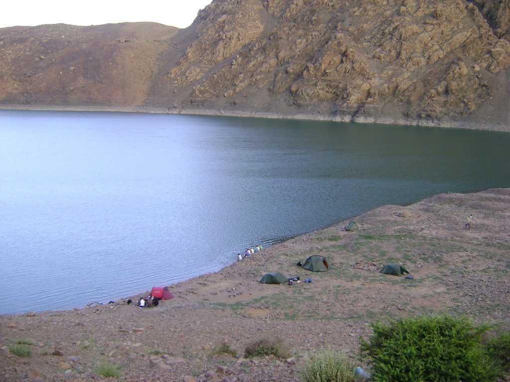
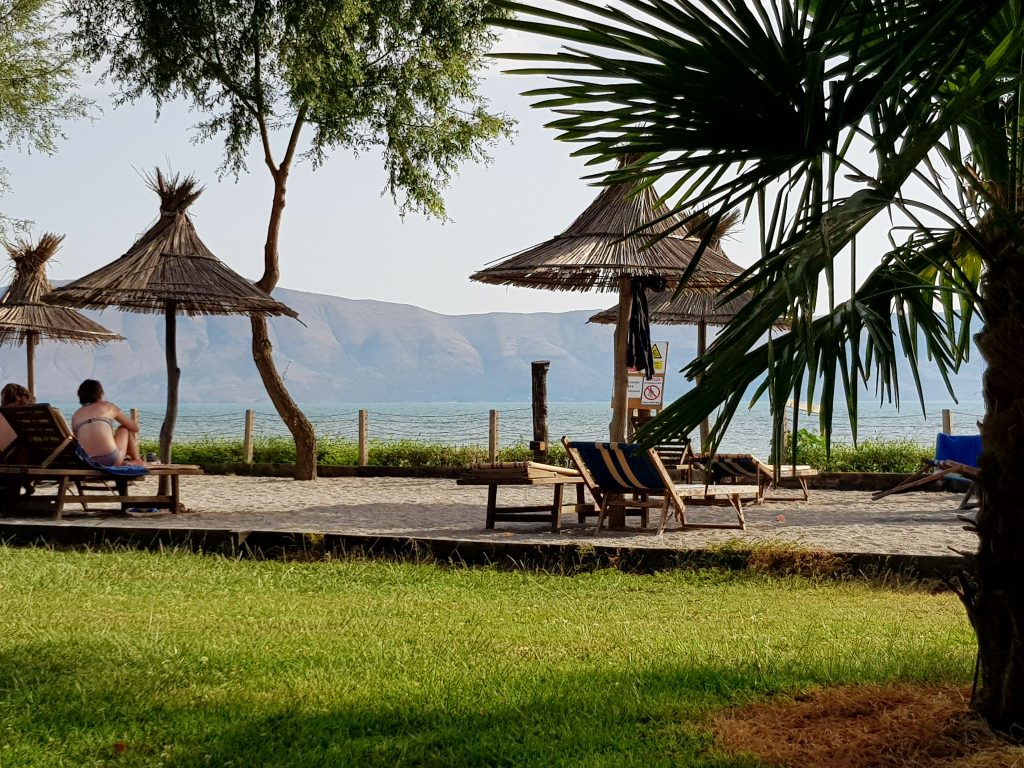
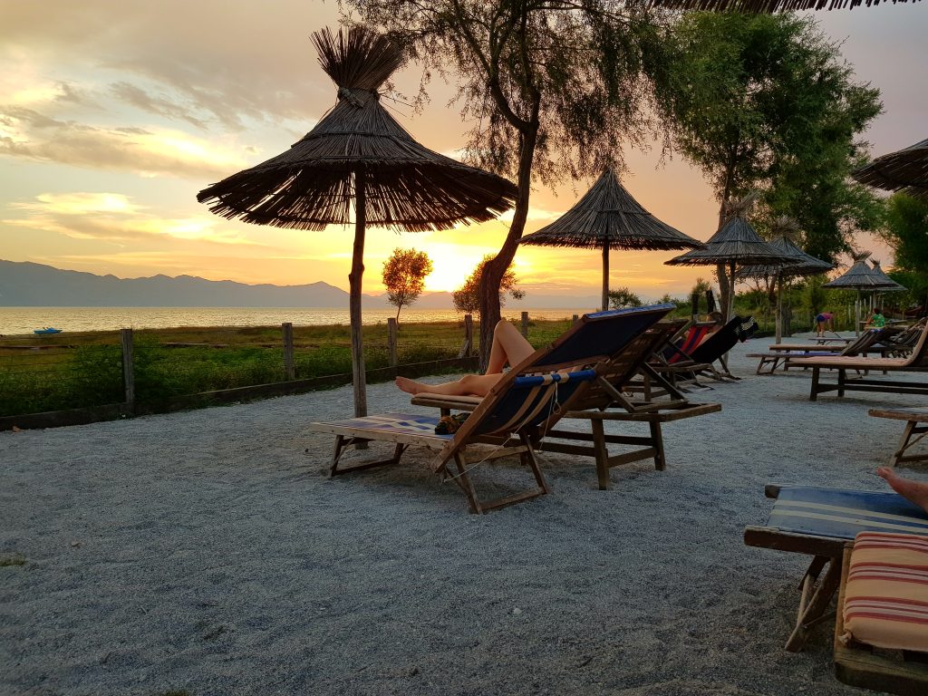
Three flights (London to Munich; Munich to Ljubljana- Slovenia and then Ljubljana to Tirana) later we were in the beautiful country of Albania in the early afternoon. A 2 hour bus ride took us from Tirana to Shkodër on the Montenegro/ Albanian border. What a magnificent camp site, beautiful lake, super food and amazing place to have as a base camp.

Acclimatisation for a day as the temperatures were in the mid 30s degree Celsius and only just dipping below 25 for the night. We spent two nights on our camp site, before we headed into the Albanian Alps further North. The best way to get there is by boat. Having made contact with Mario Molla using WhatsApp he was expecting us and a 2 hour ferry journey along Lake Komoni led us towards Fierza. Stunning scenery as we chugged our way up the Lake through twists and turns with huge Limestone cliffs either side. The only problem was that it was freezing cold! A storm had rolled in and we were all wearing just about all the clothes we had. The concept of a quick swim would have been perfect if the weather had been good but with the rain (the last time was 3 months ago) no one was keen for a dip.

We were met by another bus in Fierza and taken up to Valbone, the end of the road- literally by late afternoon.
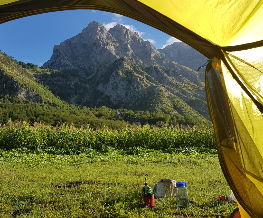
Valbona 960m

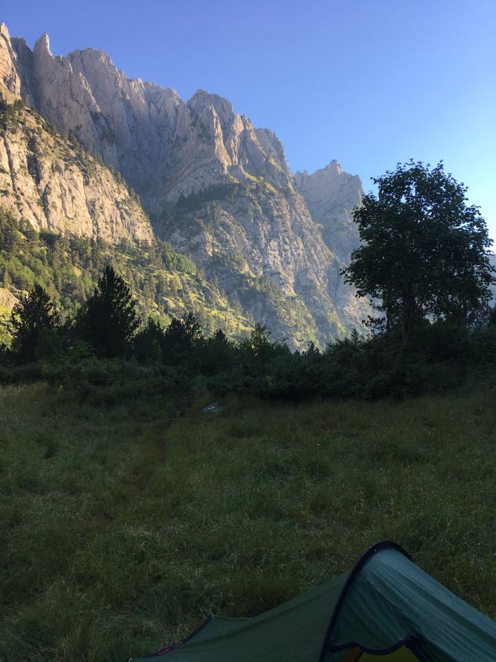
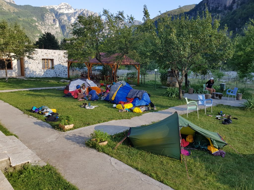
We found a good camp site with WiFi (unusual) and electricity that ran off a generator- and it was warm inside. The camp site owners managed to cook up for us a selection of meats and vegetables for a very reasonable price.  Despite it being mid summer the temperatures outside were cold- probably about 8 or 9 degrees, with a strong wind and rain.  It felt little different from other alpine villages in summer when a storm rolls in.

Through the night the rain cleared and we were met with beautiful blue sky as we headed off on our trek.

Day 1 Valbona to Çeremi 1200m 4 hours +500m height gain

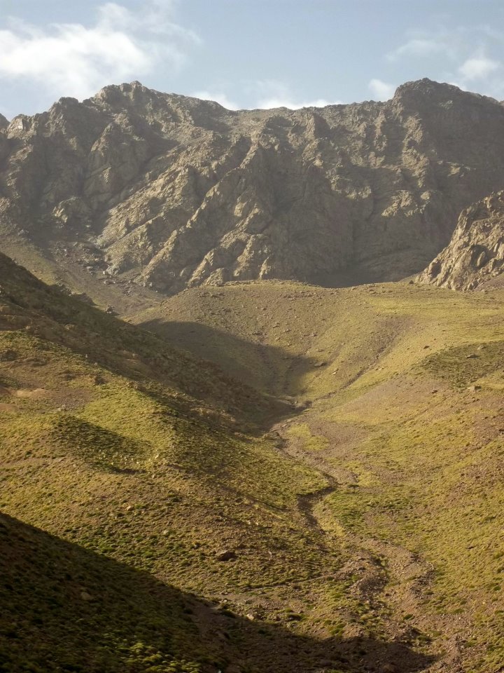
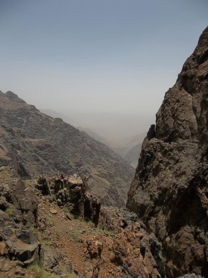
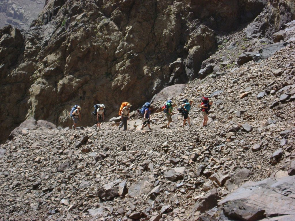
A bright blue skied morning saw us leave the camp site, head down the valley towards our left hand turn up another valley . Despite having a chat with the group at the junction, they decided to walk even further down the road and added a couple of Kms to their trek. We took the direct route and headed up the valley following the reasonably well marked trail. The main excitement of the morning was when we stumbled on the tunnelling operation. I was met by an Albanian running towards me waving his hands around clearly not keen on us continuing towards the works- a few moments later the loudest “booom” and then a second “boom” like a bomb going off and I could see why he didn’t want me to walk across the mining works.

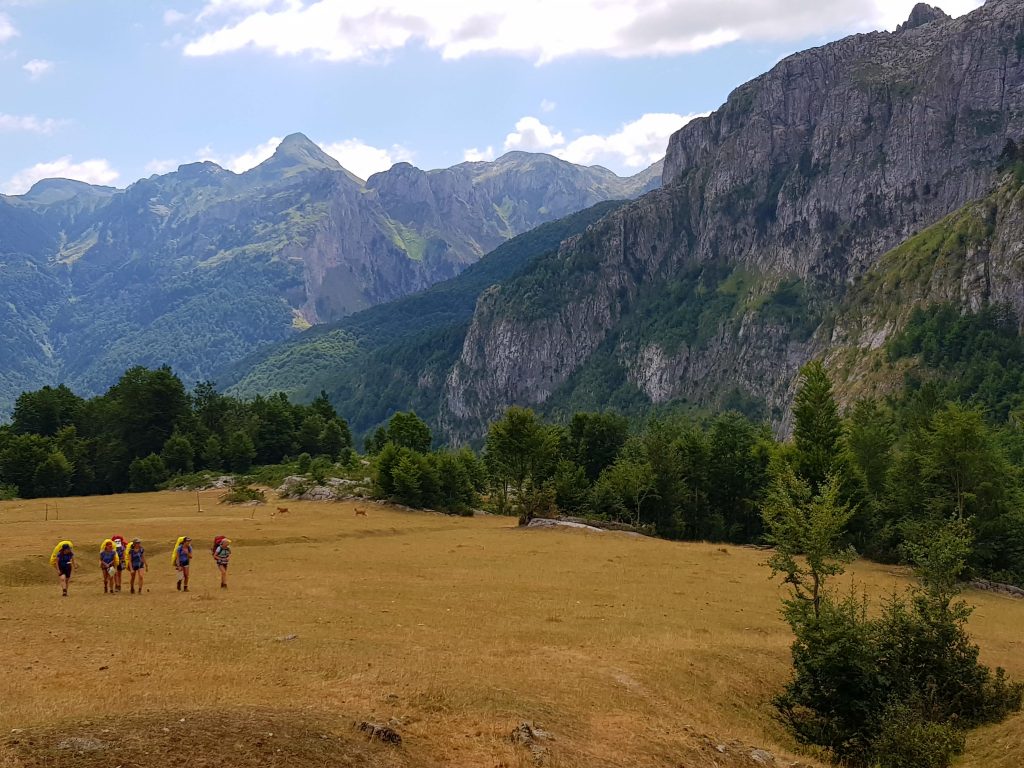
Day 2 Çeremi to Plav (in theory) 10 hours + 600m height gain

The day started well with more blue skies and because of the altitude it was decidedly nippy first thing in the morning. We tagged behind the group watching their movements. About 15 minutes from the campsite we saw a Y shaped junction and instead of taking the right hand branch we headed left! The upshot of this was that the path led us to the boarder with Montenegro, however, it wasn’t our planned border crossing and we were on the wrong path heading in the wrong direction!

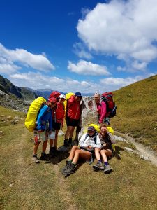
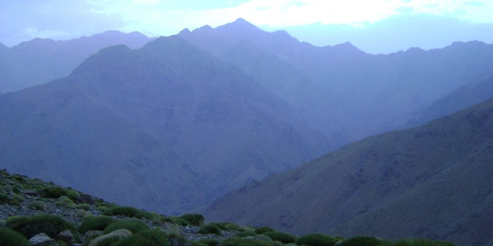
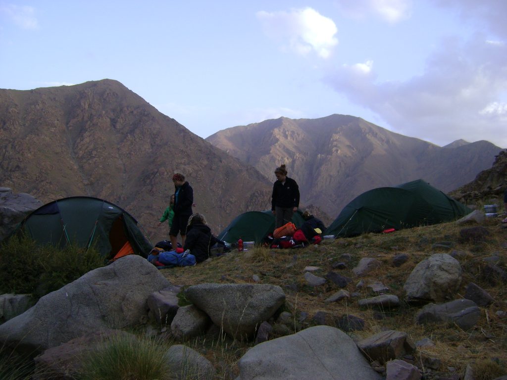
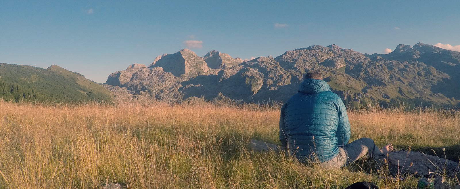
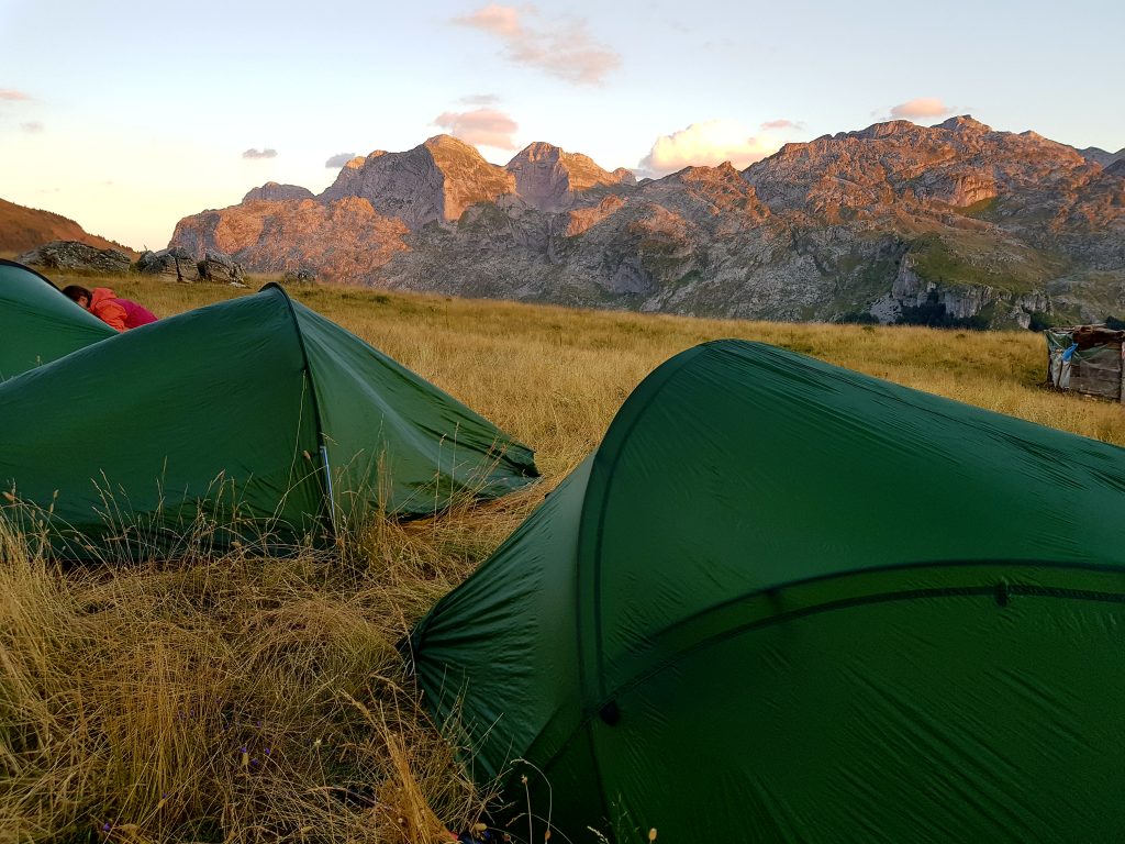
Having crossed the border and relocated ourselves we had to adjust the route for the next 1 1/2 days to bring us back into line. We followed a path heading towards Plav. Amazing views down towards the valley below we decided to camp on top next to some shepherds and their sheep. The advantage of this was that they had guns to shoot bears and wolves (which the locals proudly showed us and fired off a couple of shots). There was (to me) safety in numbers and the view from our camp site was incredible, the sun setting on the mountains nearby.
With tales of bears and wolves from the Shepherds the rest of the group were a little bit jittery that night but we were able to look out through the night onto amazing star constellations and the band of the Milky way streaming across the sky.

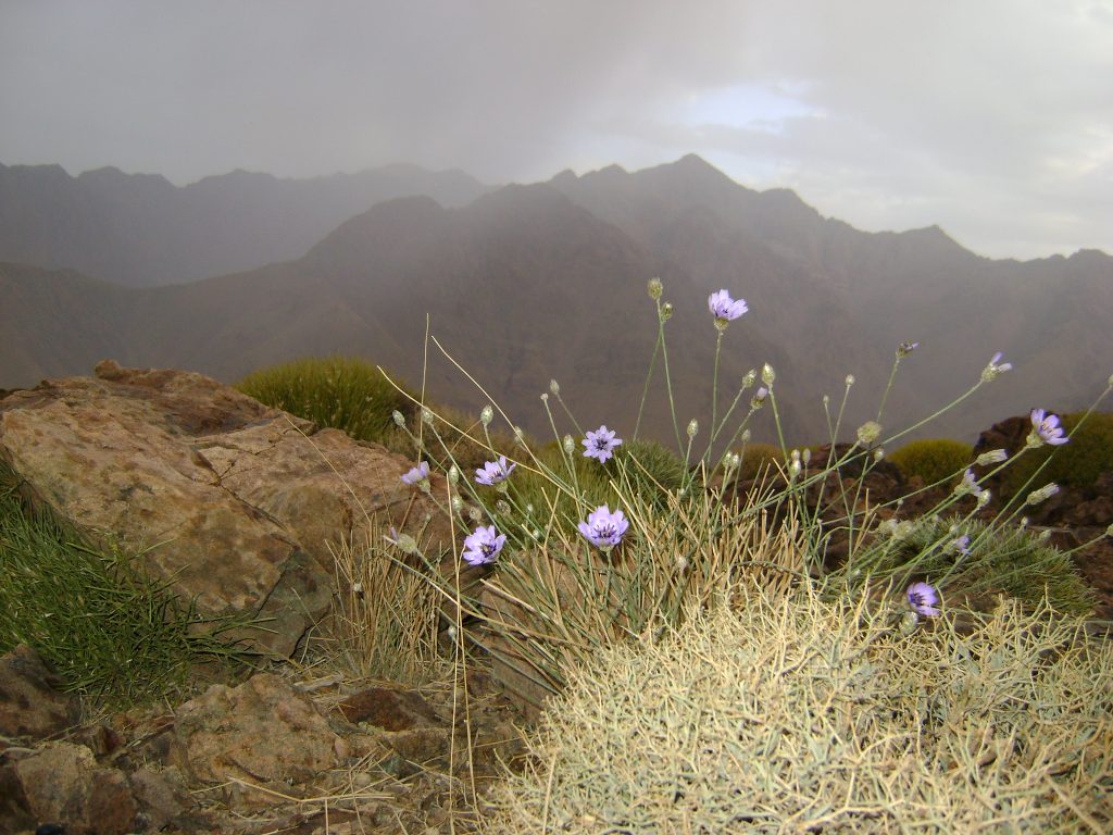
Day 3 Hillside outside Plav to Liqenet e-Gjeshtarjes (dry lake) via Gusinje 8 hours 450m height gain

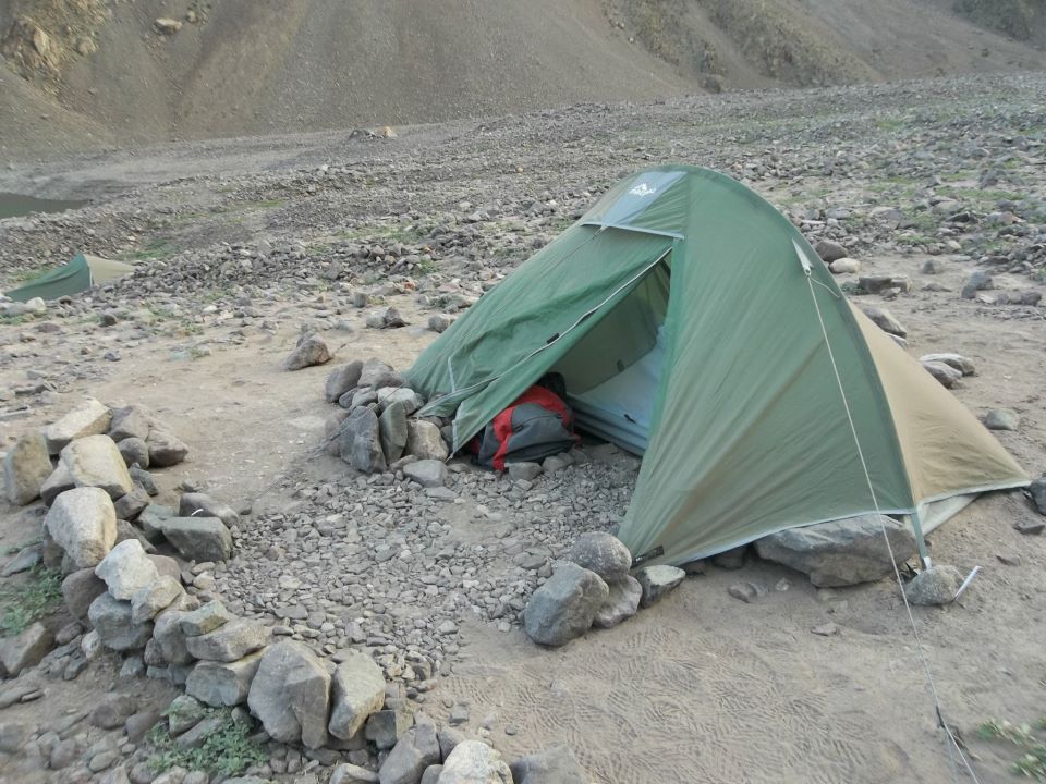
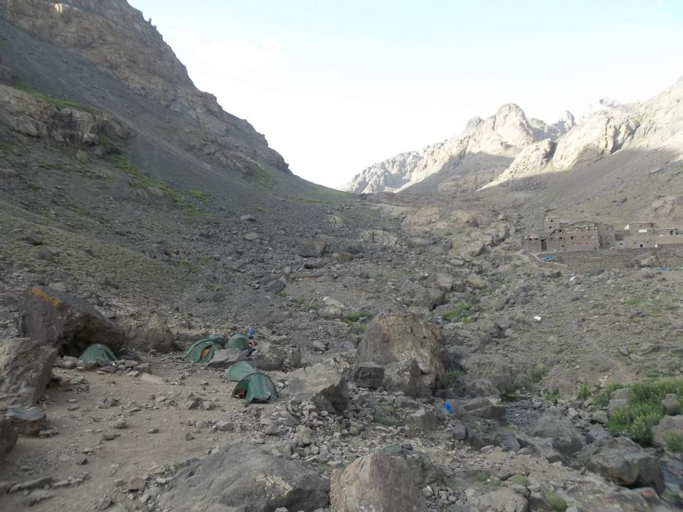
Having met up with the group again at lunchtime we started trekking back up hill towards Albania and the border crossing, our planned campsite around a lake which should have been about 6-700m in length. Sitting at 1300m it would have been comfortably cool at night and made for a good plan. However, on arriving at the lake it was completely dry and devoid of water. It was about 5pm and we were very low on water. What made matters worse was that we met another group of girls coming towards us  saying that they had not found water at all. We hunted around for a possible dribble of water but nothing was found and we set up camp that night eating any food that didn’t need to be re-hydrated.

Day 4 Liqenet e-Gjeshtarjes to Thethi 7 hours + 550m height gain

As we had nothing to drink by the morning I was up super early as the sun rose and headed off in search of water up the valley. Fortunately after about 1/2 hour came across a shepherds house with water, a series of baths and somewhere comfortable to sit. Communication with the locals was always possible and we managed to connect using my Italian (just add ‘io’ to the end of most French words) which was understood by the Shepherds. What we were able to offer them was battery power, one of them had a Samsung mobile that needed charging and we had spare power so were able to charge up their phone in exchange for fresh milk- delicious addition to my morning coffee.

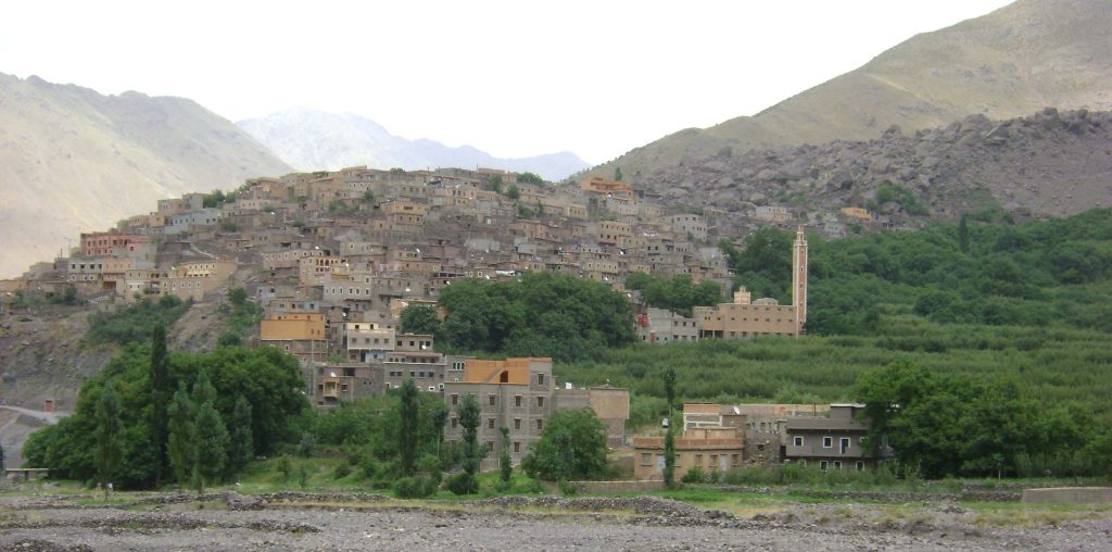
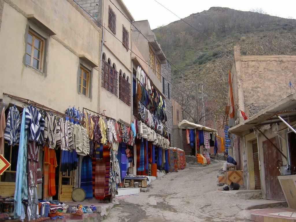
Having seen the group through the border all that remained was the steep descent into Thethi and the end of our trek. We passed numbers of people coming up the valley towards us and I was very glad to be descending this path. We arrived in Thethi (also with free phone calls and WiFi!) and stayed at a lovely little camp site just behind the visitor centre. The chance to have a shower and clean up was superb and even though a dribble came out of the tap it was great to freshen up again.

Thethi to Shkodër

A 3 hour bus journey along a very bumpy road out of Thethi took us back to our base camp and the Shkodra resort. We were back by lunch time and were able to swim in the lake all afternoon and watch the sun set that night. A great way to end the trip.


Finally some useful (?) information for trekking in Albania

  • The Lek is the official old currency for the country but you can just use Euros instead. You can get Leks from Banks in Tirana and if you buy items with Leks you will probably get change from Leks. Most people will quote you prices in Euros. You cannot get hold of Leks until you get into Albania and then if you don’t change them before you leave they are useless to exchange.
  • The Euros work everywhere and there are quite a few ATMs where you can get Euros out. But be warned, there are no ATMs in the mountains!
  • You can use your phone for free in Albania as it is part of the European network, if you use your phone in Montenegro it will cost considerably more as they do not seem (at the time of writing) to be part of the same European Roaming Network
  • People are very friendly and my experience is that they will try to help you rather than rip you off
  • Agree a price for camping before you pitch your tent, it may well work out very expensive if you don’t
  • The trails are well marked, you just need to know what you are looking for along the way

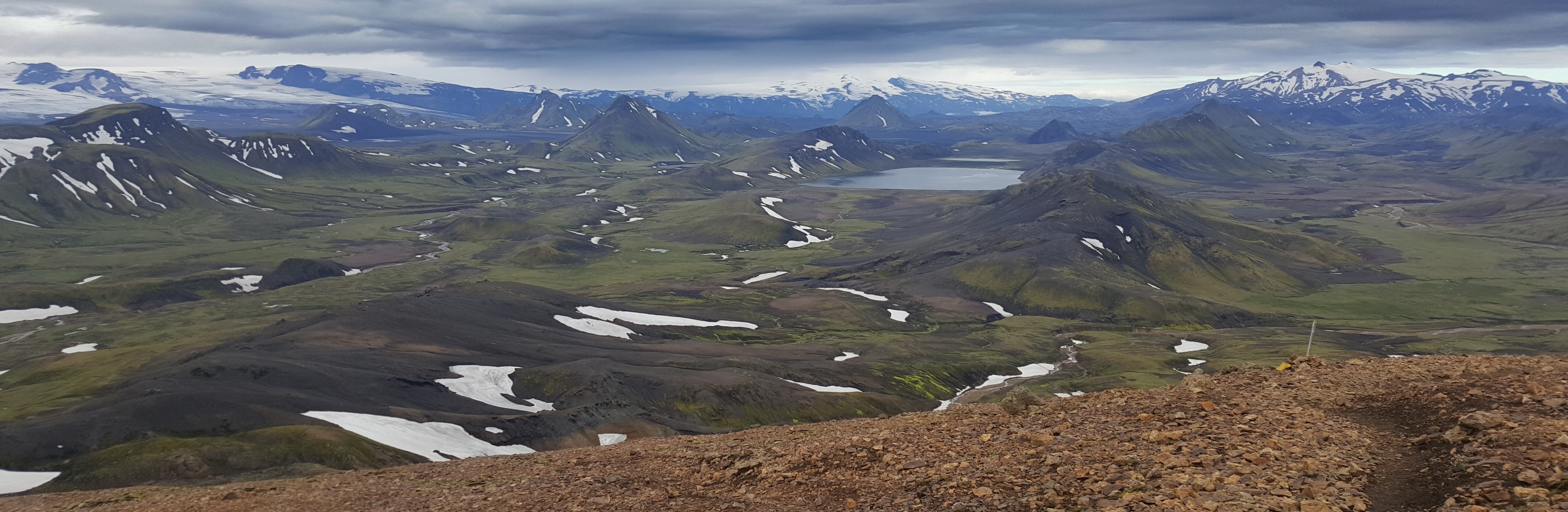
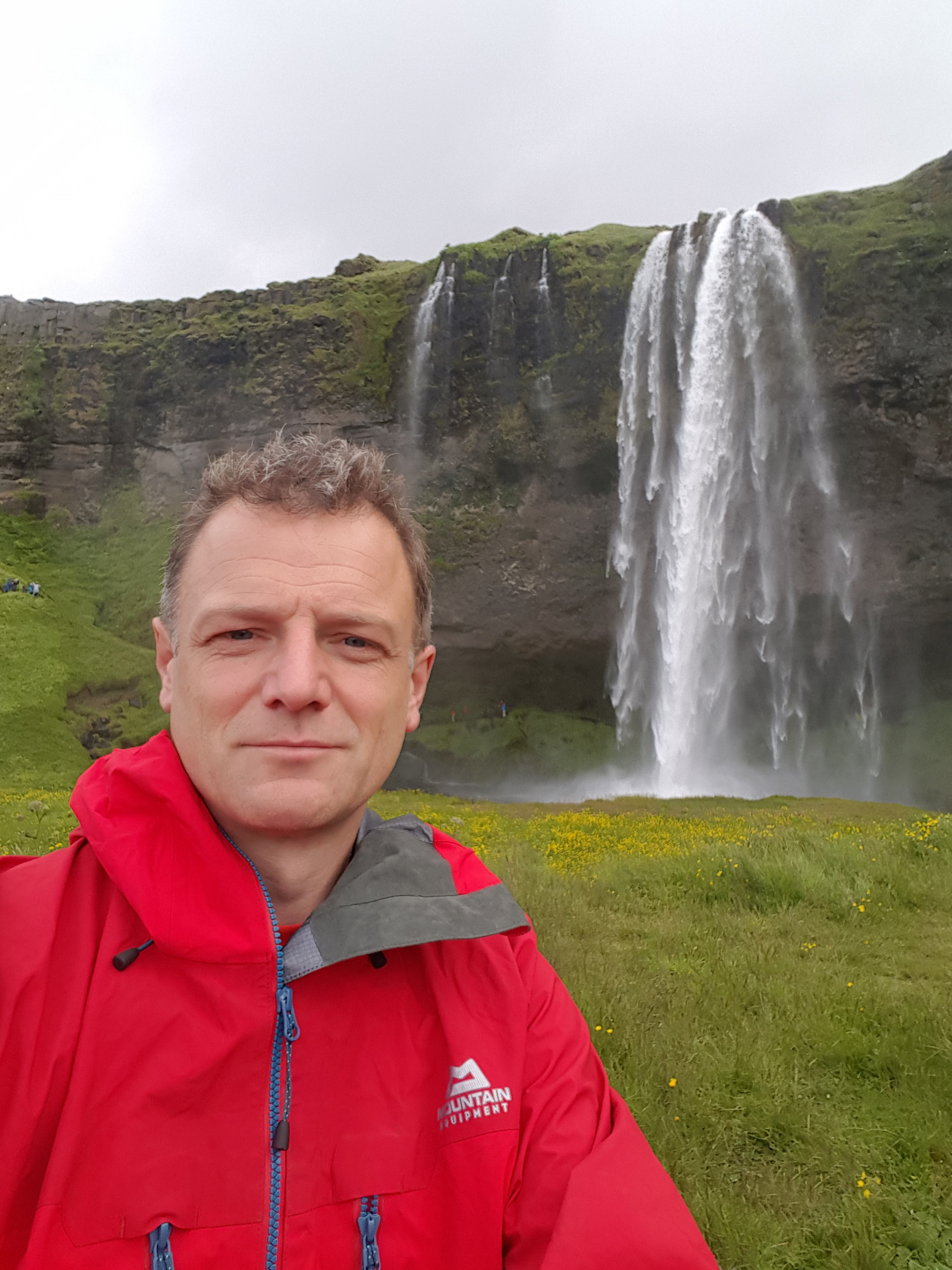
Have fun in this amazing country, have a browse of a few images from this trek.

[ngg_images source=”galleries” container_ids=”1″ display_type=”photocrati-nextgen_basic_slideshow” gallery_width=”600″ gallery_height=”400″ cycle_effect=”fade” cycle_interval=”5″ show_thumbnail_link=”1″ thumbnail_link_text=”[Show thumbnails]” order_by=”sortorder” order_direction=”ASC” returns=”included” maximum_entity_count=”500″]

Links

http://www.journeytovalbona.com/ if you want to find out more detail about Valbona

https://www.lakeshkodraresort.com/ for possibly the best base camp campsite ever on Lake Shkodra

My Diamond DofE Challenge

In May 2016 I was lucky enough to be invited to Buckingham Palace (along with quite a few other people) to a celebration of 60 years of the Duke of Edinburgh’s Award Scheme. During the afternoon celebrations I was fortunate enough to meet Prince Edward and he asked whether I was doing a Diamond Challenge this year. I felt slightly awkward because I thought I ought to do one but hadn’t really thought about what I would like to do and so said “yes” when asked. He then asked what I was going to do and I said “Walk to the coast” which was met with a chortle because he didn’t know how far it was to the coast from my house and he possibly presumed that I live by the sea. In fact I need a challenge that is going to push me, and also in my mind it needs to be a challenge considerably beyond the Gold level expedition in length.

Fast forward several DofE meetings when the Diamond Anniversary Challenge is mentioned and I know that I have until the end of 2016 to complete the challenge.

December 30

I have obtained the magic “pass” ticket from my family this Christmas time and need to start my walk tonight, I wanted to complete it after my school term finished but before the main Christmas celebrations started, however, that wasn’t possible. The weather is poor (thick fog) I don’t actually know whether my body will cope with the length of the walk or whether I will get very lost en route. Actually I reckon that I could easily walk to the coast from my house so am adding a few rules to make it more challenging these are-:

  • To do the walk at night
  • To walk as much as possible off road
  • Not to take a map (or use my smartphone for navigational aid)
  • To complete the walk completely unsupported

To appease my family (and Facebook friends) I have arranged that I will check in with them at various stages of the night and I have an android phone so the “find my friends” app won’t work!

I set off some time just after 6:30pm. The visibility is poor and I can only see a few metres ahead. I know the route out of my village to the footpath which can take me over the A3 and heading South into the Mole Valley. There is something slightly strange about heading out passing people putting out the bins as I walk towards Prince’s Covert’s woods. The last street light of Covert’s Road seeming quite symbolic to me as I head into the foggy darkness.

At about 9pm I pass near to Leatherhead and through the Mole Valley. I drop down in height to cross the River Mole and climb up the hill on the North Downs Way past Denbeigh’s Vineyard. Magically I start seeing the stars and I have climbed through the fog to a clear sky, in fact it is bright enough up here to turn my head torch off and try to navigate by the Pole Star… however now I am heading East along the North Downs way and so find it easier with my trusty compass!

The North Downs way takes me to Newlands Corner and I am there just after mid night. This is good because in my head I know that a substantial part of the walk is done. I celebrate by eating a pork pie and announcing my arrival on Facebook. I am genuinely pleased with myself because I know that having arrived here in good form- no blisters or aches or pains- I know that I will probably be able to get to the coast. The next milestone is to get to Cranleigh.

Warning. I don’t actually know where I am going! This section from the North Downs to the Downs Link at Bramley is one that I am unsure about. I don’t have a map but do know that there are sign posts for the Downs Link and provided I head South I am going to be heading in the direction of the coast!

I pick up a narrow lane and try to turn off it as soon as possible, I follow a bridleway sign which spits me out on another path and as if I am being guided by some other force I look up and miraculously see a sign for the Downs Link- I have found it- a little woop woop! and smile crosses me. I am also in good shape for reaching half way.

I enjoy the start of the Downs link path for many reasons. I have never walked it before and I pass through the disused station at Bramley and head south to Cranleigh. The town (actually according to the sign post outside it is the largest village in England) is still quiet and it is about 4am. I stop in the car park I have used in previous DofE expeditions and have a little stretch. It’s fair to say that now I am quite tired, not hugely but I can definitely feel it in my legs and feet.

I keep heading south and it seems very dark. The previous section from Bramley to Cranleigh was the first time I didn’t hear any human machinery on my journey- I have had the steady hum of cars/ trains or planes all the way to here but now it’s quiet, very quiet.

I start taking the journey in sections, counting each half hour stint and celebrating with another gel juice or energy bar.

At 5am I have had enough. I am tired and the floor is moving up and down I need to stop. I curl up on the floor and wrap myself in my tin foil blanket and shut my eyes. At this stage I could easily quit. It hurts.

Something wakes me up half an hour later and as if on auto-pilot I get up, slap myself around the face and tell myself to stop faffing around. I get going… I might not make it and I know that if I don’t get up I will want to call a cab and knock it on the head…. this is a low point.

Something inside of me keeps on pushing on and despite a 15 minute stop under a bridge where I rest from the fog (oh yes the fog has returned) and it is still dark. When will it get light??????

Amazingly I pass through various old stations on the Downs Link and get to Christ’s Hospital School. A brief section on a road around the school grounds and I see a very uplifting sight of a mile marker saying that the South Downs (and almost my finishing point) is only 15 miles… Now I am going to make it. I celebrate with a packet of Haribo and brief text conversation with my daughter who is about to head off to work for the day.

At this stage I am aching all over. My back is sore from my ruck sack. I haven’t slept properly for a long time (I don’t really count curling up on the floor in the foetal position as a proper sleep).

By 11 am I am wishing that I had brought some coffee in my ruck sack with me. I have chatted to an elderly couple who have two golden retriever dogs who politely inform me that there’s a cafe just around the corner. I hadn’t planned on going to a cafe because I am not sure whether I will be able to leave it once I have enjoyed the warmth (I think I may be slightly hypothermic at this stage too) however I take this knowledge about the coffee as a sign that I must visit it.

The rich smell of an Americano Coffee and sugary taste of home made flap jack go to my head and I nearly pass out. The poor lady in the shop asks me whether I am ok… actually I am not but for some strange reason say “I’m fine” gulp my coffee down and take the flap jack in a bag- I fear I might be sick at this stage as my arms start shaking. I need to get going.

By now it is a case of one foot in front of the other. I know I am going to get there but it is painful and I am not going to get there before mid day (the original planned arrival time). I have updated my family about my lack of progress.

Maybe it was because of the injection of coffee or whatever but I manage to cover the next couple of miles and see another sign for Shoreham and it is under 10 miles now. I start converting this into mental ParkRun laps of Bushy park, or sections of my local ParkRun.

I am complacent about reading sign posts and seem to take a wrong turn, I end on a path which leads me to another path and I do a complete circle around a village. Tired and emotional at this stage I almost cry with pain. I have added a section to my walk that I didn’t need to do. There is a bit of path from Bramber to Shoreham which seems to say Shoreham is 3 miles… one sign after another. 3 miles, that’s a park run to go. But I pass one signpost and then 20 minutes later yet another 3 miles to go sign… it’s not fair… wahhhhhhhh!

I follow the River Ardur, on the right hand side is the imposing stature of Lancing College Chapel and on the left is the noise and roar of cars on the A283. I am placing one foot in front of another. Each pace takes so much effort. The pain every time I place my foot down is quite considerable.

By this stage I am willing Shoreham beach to come closer. I can see that the sun is starting to become lower in the sky and I want to get there before it is dark. I have been up for over 30 hours and feeling very irrational.


Finally I get to Shoreham and need to find the sea. You would think that this is easy but a glance of a map of the town shows that it has a huge harbour and I want to actually find the sea, not an estuary! Fortunately there is a pedestrian bridge and I can finally see the Sea. It is there in front of me. A few minutes later- the final painful steps and I am walking over the cobbled beach and down to the sea. I dip my hands into the water and taste the salt. Made it. Phew.

I arrived just after 2:30pm nearly 19 hours since I started my walk. There was a strong sense of elation combined with an emotional outpouring. I phone home with the good news and hobble back to the town centre.

Fortunately I find another cafe which is open and buy the remaining cakes and a coke. I explain my walk to the lady serving me and she is suitably impressed. She gives me the directions to the train station and I head back  home on the train.

I am greeted at the train station by my lovely wife who has driven the 0.3 miles to collect me! I am very stiff and can hardly move at all. I hobble into my house just after 6pm nearly 24 hours since I started my walk to the coast.

On reflection these are the things that I have enjoyed about this adventure-:

  • I didn’t know whether I could actually achieve it- there was a lot of unknowns with this trip (including the distance)
  • It was a very low carbon impact expedition- walking from my house and using public transport to return home afterwards
  • I completed the round trip in under 24 hours
  • I had planned many parts of it in my head and it was basically down to me, I didn’t need to rely on anyone else
  • It was unique and a bit mad- I don’t know anyone else who has walked through the night at the end of December from Claygate to the coast!

Now to recover and plan the next adventure. And the vital stats- this walk was 101 Km in length completed in just over 19 hours

Iceland Trekking Pösmork to Landmannalaugar

It is summer 2016 and I am fortunate to be leading a school DofE group to Iceland. We are heading to the Pösmork (Thorsmork) valley and will walk the Laugavegur trail from Pösmork to Landmannalaugar.

This is the third time I have done this trek, but the first time to have walked in this direction. The first time I was on this trek was 2003 then again in 2010 and over the years it has seen more and more traffic. There has also been the internet explosion and you can now get a WiFi signal at most of the huts  and certainly phone reception all the way along the route. The first time I visited Iceland I took a satellite phone with me in case I needed assistance (or my wife who was very pregnant at the time was letting me know that my son was born!) however in 2016 a regular mobile phone will suffice- just be aware that there are limited places that you can charge your device up if you camp rather than stay in the huts.

Our first day saw us fly from the UK to Keflavik. A large delay at the airport where we worked out what had happened to our coach and driver saw us heading over the barren landscape past the Blue Lagoon (overpriced if you ask me) towards Reykjavik and our home for the night- the camp site virtually in the centre of the capital city. It is the London equivalent of being able to camp in Battersea park. From the camp site you can walk into the centre of town in about half an hour and right next door to the site is a huge open air geothermic swimming pool with slides and chutes to zoom down.

The next day we transferred to Pösmork via various interesting sights- it takes a few hours and being able to stop and look at the waterfalls breaks up the journey.

The bus wound its way up the Pösmork valley and makes some interesting river (stream?) crossings before finally stopping at the Volcano huts next to the River and to our right is the huge Eyjafjallajökull Volcano (the one that exploded in Easter 2010). We are welcomed by some lovely hosts and made to feel very welcome. Sitting inside whilst it rains outside is great and we can cook our food (the first of many imported freeze dried meals)  in one of the kitchens. A warm fire means that we can sit read/ chat/ play the guitar and get excited about our walk ahead.

Trek Day 1 Pösmork to Botnar

We depart from the camp group having weighed, re-weighed our ruck sacks. Wondered about what we can leave behind, what the heaviest food is that we can eat on day one and we are off. We head north and shortly are taking shoes and socks off for the first time to cross a stream. It is not big but would be calf deep in places and taking our shoes off means that we can have dry feet on the other side of the river.

We pass through a variety of scenery and steadily walk up hill through the dense birch forests. We have moved from the Thorsmork valley and head into more expansive vistas.

I enjoy passing the mountain Einhyrningur. I think it looks very much like a Rhino, according to Icelandic translation it is a “unicorn”. Maybe my school should put a photo of it up to match the unicorn that is next to the entrance I pass every day.

We arrive late in the day and there are many people camping at Botnar. We manage to find a space and have a small valley to ourselves near to the hut. All of the huts have toilets which are fairly clean considering the use they get. As the trail is so popular, using the hut facilities is important unless you are going to properly bury your waste.

Day distance 15Km +300m ascent approx 7 hours

the camp site at Botnar

Trek Day 2 Botnar to Alftavatn

We leave in the sunshine and walk past all the other tents closer to the hut. This day involves a number of river crossings and I am glad that the water levels are not very high. They are still high enough to mean that we have taken our shoes off and some of the cars turn around on the track rather than continuing along the F210.

After about 13Km we reach the group of huts at Hvanngil. The weather forecast is published in the window of the hut and rather than heed the warning about the weather we decide to continue onto Alftavatn. Slight mistake! The hut at Alftavatn is on a wide plane and there is no shelter at all. As we arrive at about 5pm there are many tents already pitched. We find a slot and spend the next hour or so picking up more rocks from nearby to build protective walls around our tents and rest on top of tent pegs.

Day distance 15Km Time about 7 hours

Trek Day 3 – the storm day!

We were woken regularly during the night with shouts/ screams from the pupils about the fact that their tent had blown away…! Having re-organised the group at 2am and squished students into each others tents for the night I survey the scene at about 8am. The storm is due to continue for the next 12 hours so we stay put. The decision was difficult but I knew that we would be ascending to 1600m and we had just met a group coming the other way who had complained about the depth of snow at their hut – and this is July!

Well you can’t say we were not warned

Trek Day 4 Alftavatn to Landmannalaugar

We happily set off early in the morning knowing that we have a 20+Km  walk to complete today. This is the most beautiful section in my opinion. We pass huge Rhiolitic valleys, steaming caves, boiling mud pools and the views are amazing. The bad weather has passed and we are blessed with stunning views. It is not cold but there is a brisk wind still blowing through.

After passing the hut at Hrafntinnusker we descend down to Landmannalaugar and start to see lots more people out for their day hikes from the valley. I feel as though I’m walking through middle earth, it’s steaming and there is the constant smell of Sulphur in the air, finally we make it to the camp site at Landmannalaugar and try to find a place for the tents.

The camp site is very busy by comparison to other sections of the trail. The floor is stony and tent pegs do not go very easily into the ground. However, on the plus side we are able to bath in the pool and recover- it is very cold walking down there in shorts and flip flops but lying down looking up at the evening sky trying to find warm spots in the water rather than boiling areas is a very enjoyable activity. We are also all able to chat about the walk, our recovery from the storm and plan the next phase of our trip- White water rafting and sightseeing around the Golden circle.

The huge array of tents at the Landmannalaguar campsite

Day distance: 24Km + 700m ascent

Overall the trip is 55Km long and can relatively easily be covered in 4 days- we did it in 3 because of the storm and one of the joys of going from South towards the North is that you finish up with one of the best features of the route- the natural geothermic lagoon at the end of your route. Also, going South to North means that you have the prevailing winds and sun behind you. There are pros and cons either way!

Tips for trekking in Iceland

  • shop around for coach transfers and get the cheapest- the price will vary considerably.
  • People are very pleased to see you and will probably help you
  • It will probably rain at some stage and when it does it really rains hard
  • The Landmannalaguar to Posmork trek is very popular and you will follow a trail of people doing the same trek. If you want to get away from the crowds then choose somewhere else!

The 6 P’s of exepditions

Prior Planning Prevents …..

It’s March/ April time and the summer expedition season looms. I am spending so much of my time browsing spreadsheets, reading previous blogs from other expedition leaders, talking to people on the phone (I had a lovely chat with my guide in Kenya on Friday) for the season ahead… oh and that process of checking whether payments have been made for expeditions too… all fun and games but I know that without this time and detail what happens in the summer when I am out in the field is likely to be compromised. So I know it needs to be done, and occasionally I look back at photos from previous expeditions I have organised and led and know that this is the unseen phase that comes to bear fruit in the summer… roll on June/ July and August!

which boots?

I am often asked “which walking boots should I buy?” Now, before you start reading I am not affiliated to any shop or product. They are entirely my own views here based on experience.

So here are my thoughts-:

  1. Buy the ones that fit you… don’t be sucked into the “ooh this one has been reduced by £50 or £100” or whatever… get ones that actually fit otherwise you will be in for a whole heap of issues later when you start using them.
    So when you go to the shop to try them on, take the socks that you are likely to walk in from home with you. If you usually wear two pairs of socks to walk in, take the two pairs with you to try on your boots.
  2. Just because the pair of Scarpa or Karrimor worked before when you bought your last pair 10 years ago, don’t assume that the same size 9s will fit the same way again. Manufacturers change their designs, add bits here and there, change the shape of the sole etc… your feet will still be the same size they were last year!
  3. Get the right boots for the right job. That means, if you are trekking in the UK you are not going to need the same type of boots that you might if you are going to climb Mt Blanc. So ask yourself “what am I walking on with these new boots?” is it going to be wet, dry, hot, cold… ?
  4. Consider the insole for your boot. Changing the insole to a custom design one will make all the difference and be much better than standing on the piece of cardboard that the boot manufacturer seems to provide these days. So if you spend £200 on a pair of boots I think it is outrageous to have a rubbish insole in the shoe- it’s you main point of contact with the boot and as you trudge down those steps for the last hour of the day, it’s quite possibly going to be the bit you remember most from your day out. Some manufacturers do provide good quality ones, but not all of them do.
  5. If you are going to buy a popular pair of mountain boots, put your name or initials on the outside of your boots- I have often been in mountain huts in the alps seeing a huge array of La-Sportiva Nepals all up in a line in the boot room… choosing the right pair when it is dark the next morning can be quite difficult and you don’t want to end up with someone else’s boots on as you leave the hut!
after about 10 years this pair need replacing and are on their way to the bin!

6. Go to a proper walking/ outdoors shop and try them on there- only go online if you actually know the size and pair you want. Then ask yourself the question… “if I have spent 1 hour of my time in this shop with an assistant trying on 15 or so pairs of boots to find the right ones, is it ethically correct to then go and buy them elsewhere online for a bit less?” We need high street shops to try our boots on, if we all shopped online they may disappear for ever.Finally I don’t think you can ever have too many pairs of boots. Somewhere between 5 and 10 is a good number to have in your store if you are going out often and on different terrain!

Good luck

Norway Hardangervidda

It’s August 2014 and we are about to have 10 days trekking in Norway. Initially heading up to Trolltunga then to the Hardangervidda and a 4 or 5 day trek across the plateau.

We flew with BA from Heathrow to Bergen and had landed by 11am. We picked up our minibus and headed East. On our route we drove along the E16 through the pretty town of Voss and across the new bridge over Eidfjord towards Odda.

We found a good spot to camp next to the Fjord and set up our tents- fortunately in the dry because about half an hour after we pitched camp the rain began to fall, which did have the benefit of sending the midges away!

An early start to the next day. There are two ways to get onto the plateau, a twisting winding path or straight up the old mine shaft one step after another. About an hour later we were at the top with burning legs. A shock to the system and I was glad no one fell down through the wooden railway sleepers.

The path ambled its way over the plateau and you had glimpses of something spectacular when the clouds opened.

Morocco High Atlas Trekking around Jebel Toubkal

It’s July and we are off on a Gold DofE adventure to Morocco.The group have planned the trek and we are using Imlil as our base camp. A 4 day loop around Jebel Toubkal crossing a number of high passes.


A 3 hour flight from Gatwick airport to Marakesh with EasyJet was great apart from the fact that I managed to book us on the first flight of the day (oh why I ask myself?) so we flew out at 0600- having to check in 2 hours before and therefore waking in the middle of the night to depart… Hey ho!
We were met at the airport by my taxi driver who took us all the way to our guest house at Imlil about 1 1/2 hours away. Our arrival at the end of the morning meant that we were encouraged to have some fresh tea- a delicacy that is uniquely Moroccan. It was incredible to be sitting in a Moroccan garden drinking tea at 11am when we had been in the UK earlier that morning.

We were given a choice of accommodation options and the team chose to sleep on the roof- again uniquely Moroccan. The stars and milky way were something else as we looked up at the skies later in the evening. Amazing.

Roof top camping at Imlil

Imlil Acclimatise day

The next day was spent sorting out food and discussing our route over the next 4 days. Imlil lies at 1700m and virtually everywhere is up so it was useful to spend a day sorting out things and pottering around. The hotel owner couldn’t believe that we didn’t want a mule to carry our back packs- trying to communicate the 20 conditions for the DofE scheme in pigeon French to an Arab was quite difficult.

Tacheddirt to Azib Likemt

A slight change in plan meant that we hopped into a taxi which took us about half an hour East from Imlil to the start of our trek.The tarmac (?) road finishes in Tacheddirt and a series of paths zig zag their way up the hillside.

We certainly noticed the altitude having just come from sea level in the UK. Tacheddirt is at 2314m and we needed to cross the Tizi Likemt col at 3625. The only way was up! A steady plod was called for and in a couple of hours I was at the col- the group however, found it a bit more tiresome and after several rest stops they too crossed the col.

Wild camp near Azib Likemt

Azib Likemt to Lago de Ifni

The next day we woke early to drop further down towards AzibTamenzift and then south towards Tizi n’Ououraine 3120m the high point of our day. The group decided that it was a good idea to follow the stream rather than the path which was fine until they ended up below a waterfall and we looked down on them from about 100 foot above!
Rather than turn around they then spent about 2 hours playing in the waterfall and enjoying being cooled by the water. This meant that we were not at the col until late in the day and not down to Amzouzart (1740m) until late in the afternoon. The trek up from Amzouzart to Lago do Ifni (2312m) was a slog. Hard hard work and it was a long day- 15 hours in total for the group.

Well there are worse places to make a camp and we managed to swim, play cards, sleep, swim, play cards…. oh and eat too. It’s a magnificent place and there is a little community of Berber tribes-people who live up there and can offer simple food and the occasional coke too!

Well what else is there to do when you have time on your hands?

Lago de Ifni to Refugio de Toubkal

We set off in the dark, eager to get as much climbing done before the temperatures rose again. Out of the back of the lake a path took us steadily to the col at Tizi n’Ouanoums at 3680m and we could see the summit of Jebel Toubkal at 4167m to our right.


We descended down to the CAF refuge at 3200m and civilisation! People, noise, donkeys, it was all happening around the refuge, including a large number of European travellers, something we had not seen for a few days.

CAF Refugio de Toubkal to Imlil

There was the option of heading back up and bagging the Jebel Toubkal summit (a 3 hour trek/ slog) but the group decided that they had had enough and wanted to head back to Imlil that morning.  We passed a number of groups heading up on their way to the refuge and also a large number of dukkas/ shops/ trading stations where you could get fresh orange juice and omelettes. Such a refreshing change from boil in the bag food that we had been eating for the past 3 days.

It was a long descent down the valley to Imlil and took most of the day, on the way we headed past Sidi (Saint) Charmharouch at 2350m which is a collection of Berber shops and where some people make a pilgrimage and sacrifice animals.

The valley becomes wider and we passed through the town of Aremd (1945m) before finally descending into Imlil. What a trip!

We spent the night (again on the roof because the group wanted the view) resting at our gite before being taken down into Marrakesh by our taxi. The day was spent cleaning up and being a tourist looking at the various leather, herb/ spices and carpet shops as well as enjoying the coffee.

I would love to say that we all then returned smoothly back to the UK, however, a bug that was shared from food we took at one of the restaurants in the square meant that most of the group were up all night being ill. The following day a delay on our flight meant that rather than arriving back at 2pm we actually returned at 2am the following day. What a mess and slightly took the edge off our return. However, we all made it back and could then recover in the UK.

Things to think about for next time

  • The first flight out at 6am  is not the best one to catch because it means you are very tired by the time you arrive, even if you sleep on the plane
  • You need to be able to speak French to communicate. Most of the locals do not speak English so your option is French, Berbese or Arabic.
  • You can buy meths (alcool à brûler) in Imlil. You can also buy petrol for a multi fuel stove further down the valley at a petrol station.
  • Mobile phones work everywhere
  • Taking a group of teenagers to trek over passes at 3500m or more is hard work and they can do it but it takes ages- forget Naismith’s rule by a mile for timings!

Expedition home

Mt Kenya Nelion and Batian 5189m

Batian (5199m) and Nelion (5189m)

Geology and Glaciology

Mt. Kenya is a volcano, about 3 million years old.
The original cone was possibly over 6000m high but erosion, mainly glacial, has worn away the original upper part of this and left in its place a jagged glacial topography of knife-edge ridges, pryamidal peaks.
The main peaks, Batian and Nelion are part of the ‘plug’. They are composed of nepheline-syenite which is a coarse- grained, intrusive igneous rock. The rocks of the lower slopes are of various different lavas and agglomerates.
At present the glaciers are retreating at an accelerating rate; the ice is also becoming thinner. It has been estimated that if the present rend continues, in 25 years there may well be no permanent ice left on the mountian. Since records were first made in 1893, seven of the 18 glaciers then recorded have disappeared.

The summit is actually made of three peaks- the one you go up if you are a walker is Pt Lenana but to get to the proper top (Batian or Nelion) you’ve got to climb and use your hands!

Nelion 5189m via the SW face

The time to do this route in summer conditions (rock) is Dec or Jan. There are 12 hours of sunlight as the Mountain is slap bang on the equator.

The route is given UIAA Grade IV (USA 5.5 or 5.6) and the guidebook is 5hrs to the summit. I would allow quite a lot more time than that for your first attempt. See my notes about route finding below.

The rock is glorious granite- it’s amazing and completely different from all the other rock in Kenya and East Africa.

You have basically got a 400m-450m climb at about scramble UK grade 3 with one or two pitches of V Diff/ Severe towards the top of the mountain. If you pitch everything you’ve got about 20 of them in ascent!

The main issues are route finding and keeping going at 5000m. The climbing is not technically hard. It is exposed in places and there is lots of tat on the mountain to help guide you up it.

About half way up is Baille’s bivouac which you need to reach in good time if you’re going to return in the light. Just beyond the bivouac you will disappear over the ridge and accross the mountain into a different series of ledges- including the crux, De Graaf’s Variation.

Kit requirements

You only need a 50m rope. There are bolts on the SW face every 25m and you will come across them on your way up- you do really need 50m though, if you have to cut the rope for tat then you might need to bounce at the bottom of the rope.
My suggestion would be to make a mental note on the way up as to where these bolts are so that you can head in the right direction on your descent.
If you’re on 1/2 ropes you will find it easier, except for the potential of your ropes getting stuck as you pull them through.
Climbing rack required-:
x4 or 5 quick draws
x1 set nuts 1-10
x3 slings
x3 cam devices
prussik cord
abseil device/ belay device

I used my B2 walking boots both times I ascended this route.